Warner Robbins AFB, GAGeologic/Hydrologic Modeling ProcessClick on any thumbnail to get a better view. |
Contact us for pricing options and additional information:
(757) 498-6118 Ext - 101 |
||
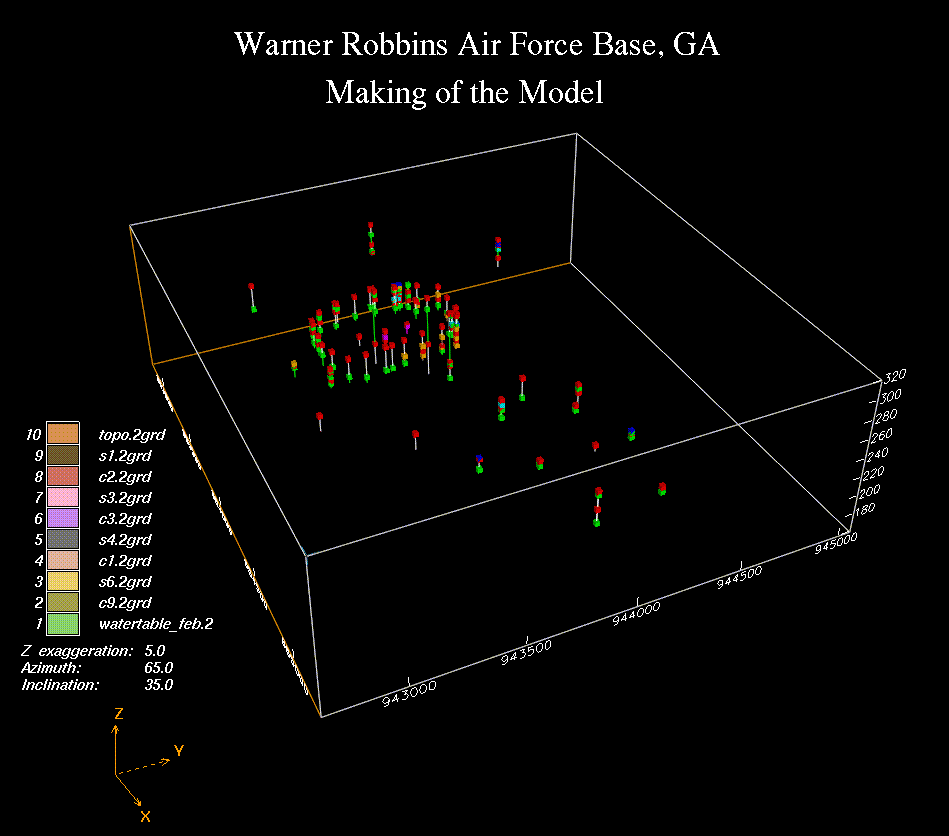 Making of the model |
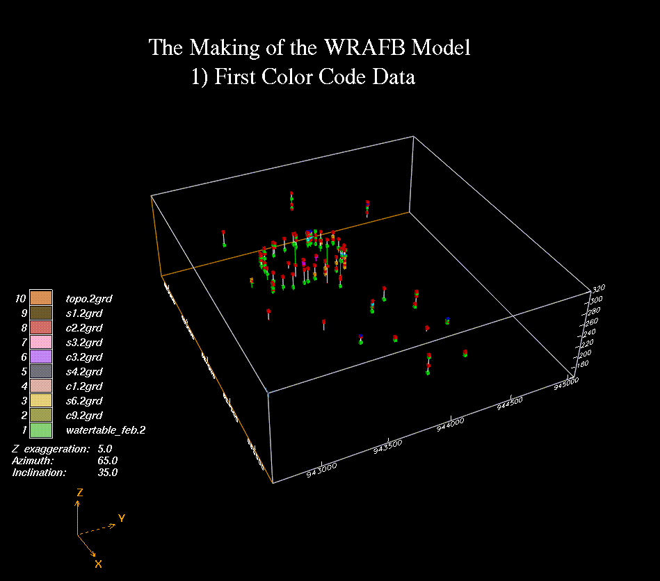 First Color Code Data |
||
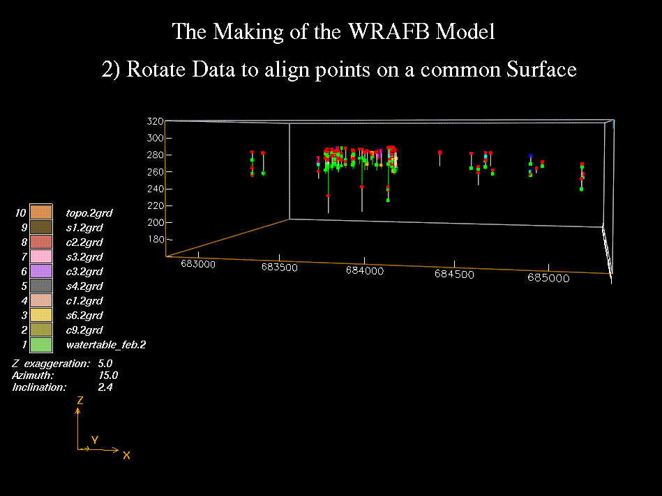 Rotate Data to align points on a common surface |
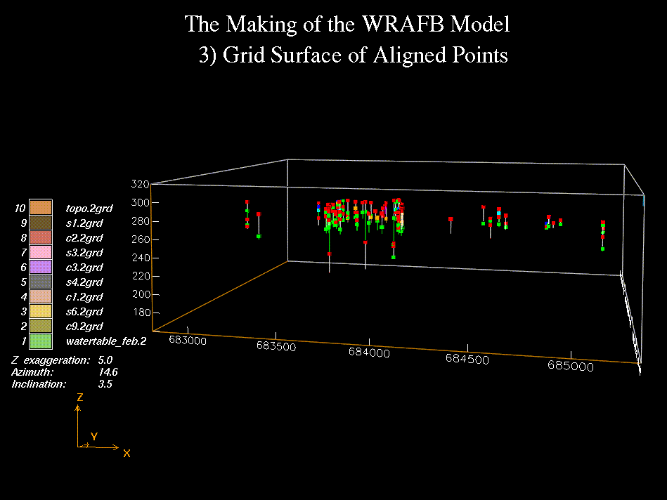 Grid surface of aligned points |
||
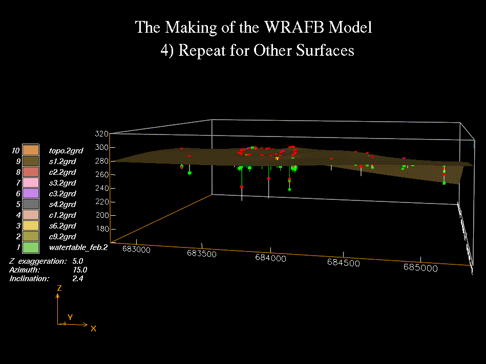 Repeat for other surfaces |
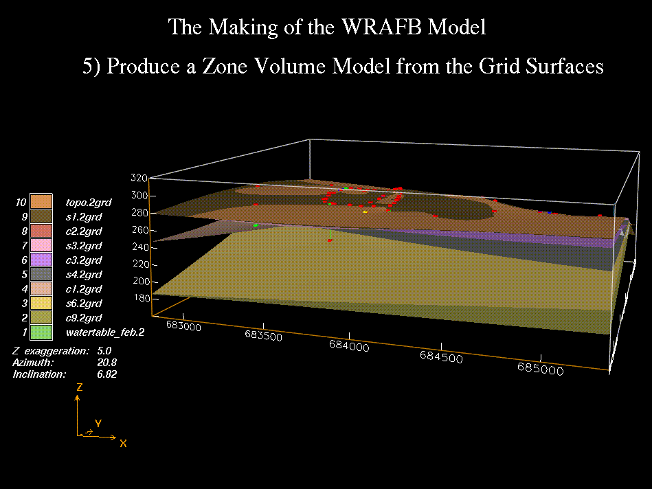 Produce a zone volume model from the grid surfaces |
||
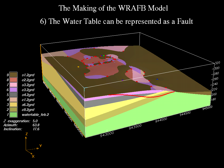 The water table can be represented as a fault |
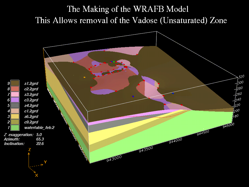 This allows removal of the vadose (unsaturated) zone |
||
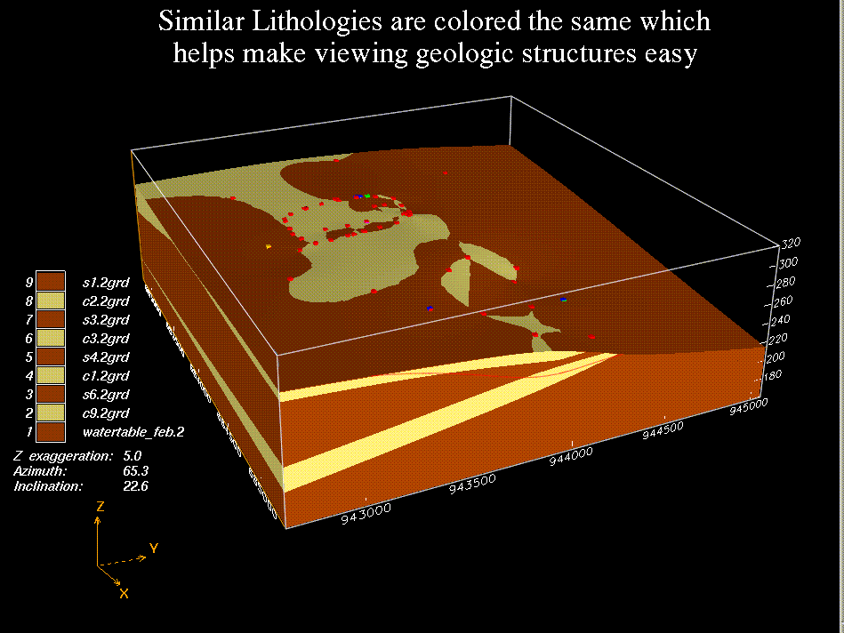 Similar lithologies are colored the same which makes viewing easier |
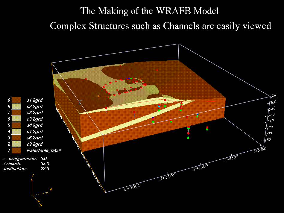 Complex structures such as channels are easily viewed |
||
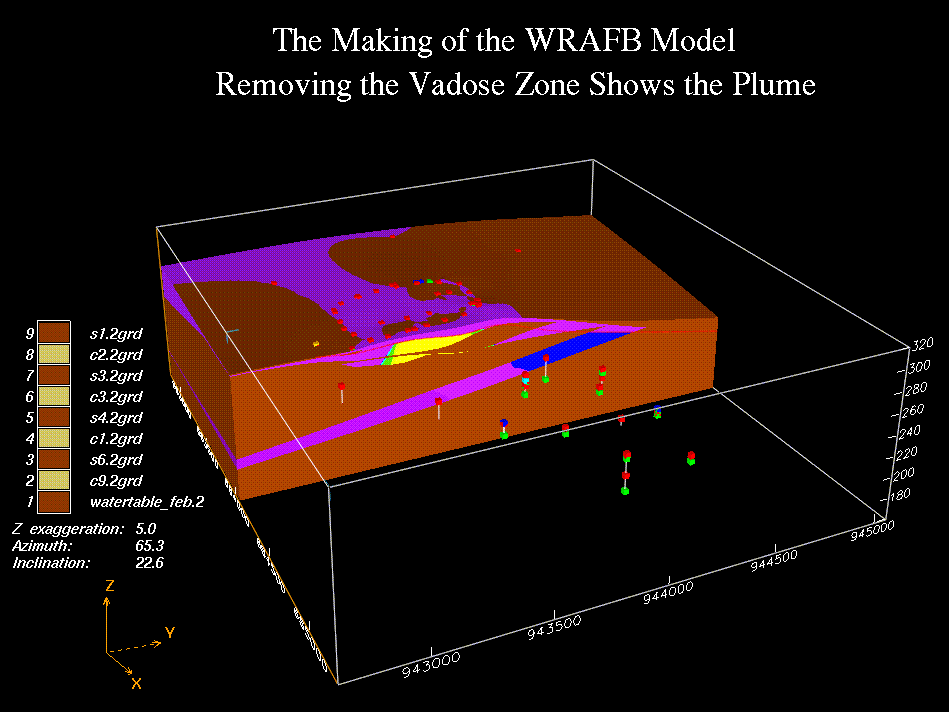 Removing the vadose zone shows the plume |
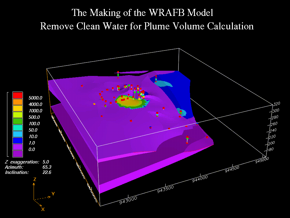 Remove clean water for plume volume calculation |
||
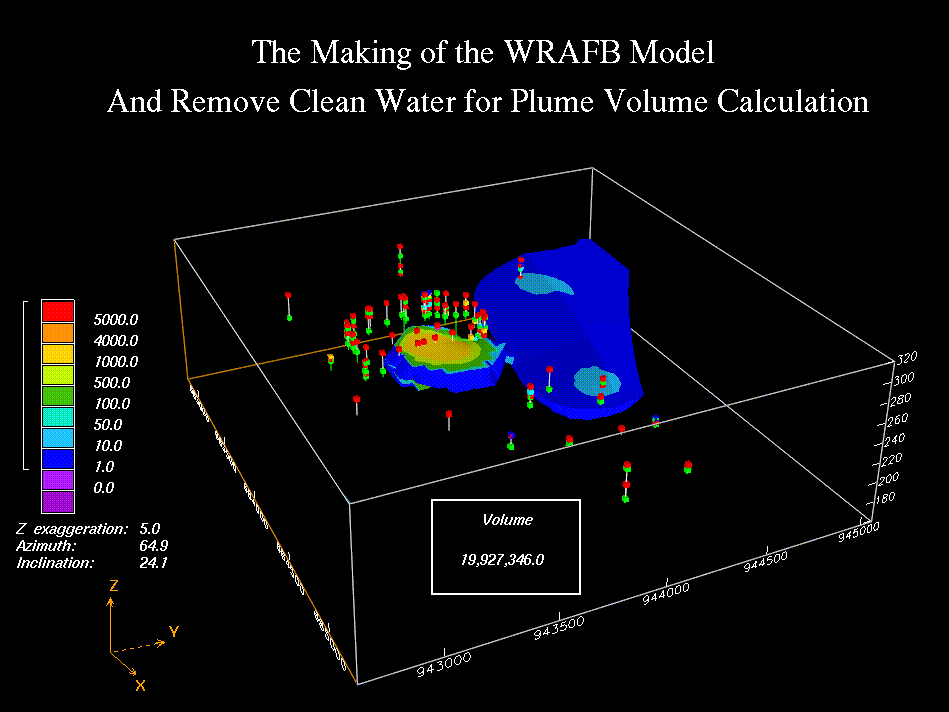 Removing clean water for plume volume calculation |
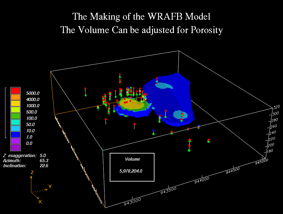 The volume can be adjusted for porosity |
||
| © Loyola Terrain Services 2018 | |||
A certified Service Disabled Veteran and Minority Owned Small Business.